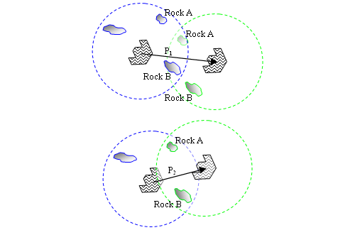
Alignment of two overhead mosaics of surface images taken from two different rover positions. Above: miscorrelation of surface features (Rocks A and B) from localization error. Below: improved correlation of surface features and estimated rover position after manual image alignment.